Surat Safe Habitat – Planning and Design Competition

Integrated Design for LA Journal • Apr 18, 2011

Theme II - “Spatial Area planning of low lying area with high flood risk” Integrated Design

While the increasing number and intensity of extreme weather events materialize the critical pace of climate change, the extent of social and spatial impacts prove the extreme vulnerability of cities and their limited capacities to respond to major ecological crisis (Haq et al, 2007). To cope with these threats, cities can no longer be apprehended as merely physical artefacts; dynamic and evolving interactions between urbanism, environment and society should inform a balanced urban development model with capacities to become reversible (Mostafavi). Given the manifestations of urbanisation in the country, innovations to strengthen resilience capacity while mitigating impacts of climate change events need to be established to adequately respond to societal and urban imperatives.
The Indian competition “Surat Safe Habitat ” organised in partnership between the Surat Municipal Corporation (SMC), Gujarat State Disaster Management Authority (GSDMA) and the Asian Cities Climate Change Resilience Network (ACCCRN), is an initiative that aims at stimulating debate and encourage design and planning innovations to address the challenges of urbanisation for natural and industrial risks prone areas.
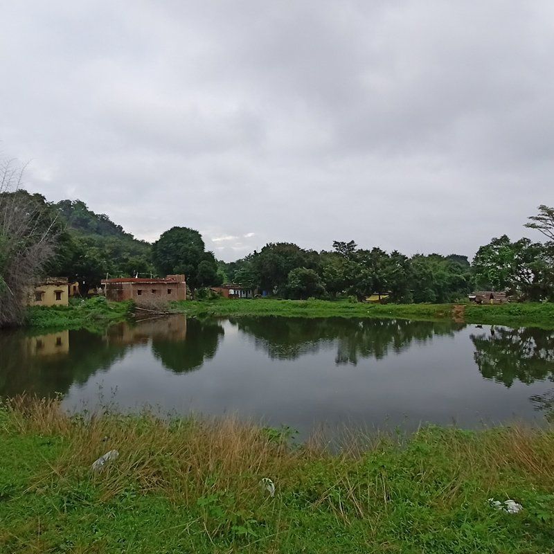
Surat is located on the bank of the perennial river Tapi and close to the estuary created by the convergence of Tapi river and Arabian sea. Being a tropical coastal city, heavy monsoon rain has regularly brought floods in the river catchment areas. In the last decade, the city has witnessed two major floods, the worst being in 2006, adversely impacting low-lying areas in the city. 

The 145 ha site in Ichapor selected for the competition is one such low-lying area which often gets flooded due to both the ingress of water during high tide time as also when the river overflows due to discharge from upstream dam. Besides natural hazards, the site is criss-crossed by a network of extra-high tension lines, underground gas and petroleum lines and is surrounded by petro-chemical industrial complexes. To respond to these challenges, the approach undertaken by the firm was based primarily on two parallel yet interrelated strategies of ‘land value economics’ and ‘landscape infrastructure’ that seek to inform a multidisciplinary proposal to reinvent a strategy reconciling the inherent conflicts between urbanism and ecology. In relation to the ‘natural and industrial risk’ parameters of the site (Ichapor) and its regional location, the development strategy was grounded on the potentials and limitations of the existing micro-planning tool (the Town Planning Scheme or TPS), and its necessary remodelling to provide a more equitable and balanced form of development and social structure. Within such a strategy the introduction of ‘Ecological Infrastructure’ as a design tool not only allowed reworking land dynamics and economics by equating non-built components in tandem with built fractions - as opposed to conventional notions but also derive malleable urban relations by negotiating natural (flood mitigation) and social (urban spaces) for the low lying, flood prone site.New Paragraph

1. Creating an ecology for the site

Establishing an inter-related development scheme 

As a low-lying area, the assessment of regional flooding patterns has been identified as the main driver for the site development. Conceiving the site within an ecological loop allows it to be connected not just environmentally but also socially and politically to benefit from large scale strategies. It offers a regional approach that is more integrated in nature rather than one which is isolated from its large environment.New Paragraph

Establishing an inter-related development scheme 

Based on the existing and future regional distribution in the Surat Region, it was critical to position the site in association and relation to its neighbouring residential and industrial developments. It is evident from prevalent development pattern that most of them are structured in isolation while ignoring neighbouring ones, containing only local services to suit present day needs while lacking larger institutional services to sustain the development. Such isolation is also evident in industrial developments creating smaller localized development patterns which have no interaction and services contributing little to the larger regional demands in social, environmental and functional terms.

A need for introducing shared services has been identified as critical to enable regional associations and promote inter-related development patterns.
Figure 1 illustrates the urban-ecological system that is proposed within the Ichapor Site. By introducing two critical functions i.e. ecological infrastructure and public amenities, the associative services generated allows for a strong inter-linkage between the residential facilities and the industrial needs that will contribute to an overall integrated pattern of development.


Performing ecological infrastructure

Ecological or Green infrastructure refers to an “interconnected green space network (including natural features, public and private conservation lands, working lands with conservation values and other protected green spaces) that is planned and managed for its natural resource and values and for the associated benefits it confers to human population” (Benedict and Mc Mahon). Part of the ecological Infrastructure, the concept of productive landscape needs to be understood and commissioned through a different set of parameters as compared to agriculture and horticulture. 
It conserves natural resources while enhancing the social and economic potential of the land within the context of urban development. In the context of Surat, it aims to respond to the flooding events, acting as both a catalyst for non-irrigated cultivation as well as a mitigating measure through the effective use of wetlands. Sustained by performant mediums such as bio swales, natural ground cover, soft treatment of the river edge, phyto-remediation, floodplains, etc, productive landscape allows a more measured and appropriate response to the hydrological demands of the site. 

By correlating urban development with the performance of productive landscape and more largely with ecological infrastructures, it reduces the reliance on engineered systems and allows the flood waters more malleable and organic space. For instance, flood plains provide space for storage and conveyance during periods when the flow exceeds channel boundaries and hence ensure adaptation to flood frequency and intensity. They reduce flood velocities and peak flow rates by out-of-stream bank passage of storm water through dense vegetation. 
In contrast to natural systems, construction of embankments along the Tapi river and its canals in Surat is bound to worsen the problems of floods with time. By confining the flood waters to the river channel and a narrow passage, embankments force the sediment load which would have ideally been deposited over a much wider area into a limited channel, resulting in higher flood levels and increased flood water velocity. By depriving the wider flood plains of the sediment deposits left behind by receding flood waters, it reduces the natural fertility of river banks which is vital for sustenance of agriculture.

To effectively demonstrate the higher performance and values of Ecological infrastructures, a detailed set of parameters has been assessed and compared to engineered and centralized infrastructure through multiples indices including maintenance, implementation, flood mitigation, environmental, social and economic benefits. 

Materializing site development

The physical form of the site plan has been derived from several conflicting forces acting on-ground: the water course and annual flooding footprint, embedded gas lines and high tension power lines, limited access bound by railway corridors, etc. 
A mixed land-use structure with shops fronting the main road encourages continuous pedestrian activity and hence safer streets. The massing of the built form is staggered and provides for terraces and plazas that help in mutually shading the building as well as the pedestrian street below. The residential land use is one level above the ground plane on arterial roads and raised on stilts along intermediate roads, ensuring maximum flood protection. The built-edge engages pedestrian movements through a multitude of activities occurring at various levels, as opposed to being a rigid physical and visual barrier between the street and the building.
In addition to large areas of productive landscape, specific open spaces are identified to serve the needs of neighbourhood. The built and green space structures alternate along the main arterial road in 
a manner which ensures at least one edge of the road always connects directly with the green network. At critical nodes, this edge is treated as a public plaza that extends into the productive landscape increasing pedestrian accessibility. 
The spaces rendered unbuildable by the power lines are transformed into a productive landscape model while ensuring all safety norms. The landscape is treated such that there is a constant presence of protective and productive landscape. While the ground over the embedded lines itself would be planted with shallow rooted seasonals, the ground away from the lines is progressively planted with second and third tier vegetation of a more permanent nature, culminating in a dense tree cover along the edge of the buffer zone. At the junctions of the crossing over the railway track, the edge of the landscape is raised and merged at the level of the freight line so as to embed the track within the landscape and create a seamless plane of movement. 

2. Re-defining an equitable model for development

Along with the physical design which aims to implement adaptable mitigation measures, a new model for development has been defined to respond to the limitations of Town Planning Scheme in the context of industrial and natural hazards, and hence ensure wider benefits of local communities
Being a micro-planning tool, the Town Planning Scheme (TPS) promotes land transformation mechanisms whereby land parcels are reshaped and re-adjusted without transferring ownership (S. Ballarney, 2008). While a portion of land parcels are appropriated for roads, infrastructure and public amenities, it is nevertheless assumed the overall land value will increase several times as plots become more organised and accessible with better infrastructure. 
Given the low-lying flood prone nature of the area and the numerous extra high tension lines that traverse the site, many parcels are affected by a high degree of exposure to natural and industrial hazard risks. Future development will further exacerbate the disparity between owners as plots with lesser risk will be developed first– increasing their value - while the remaining plots with higher risk will most likely remain undeveloped and be considered as “undesirable”. The inequity among owners will severely compromise the economic and social balance of the entire Town Planning Scheme. Unfortunately, the existing legal framework does not make provision to assess externals risks (both industrial and natural hazards) and compensate owners for the lost of land value. 
To mitigate the existing risks, the proposed physical planning has clearly assigned lands suitable for built development and land not suitable for built development but with economically productive urban functions i.e. productive landscapes. 

Given the inequitable risk distribution on the site, defining an equitable sharing system that should neither compromise the owners’ rights nor the land value has constituted a critical objective of the approach. 
To this end, the proposed model suggests that all the individual parcels shall be unified together to form a single site treated as a single physical and financial entity (using land pooling mechanism). As land is pooled together and not subdivided, development right shall be defined uniformly for the entire site and then shared between individual land owners proportional to their initial land holding. Having demonstrated the value of ecological infrastructure, the development right encompasses the productive performance of the land and includes a share of the built-up right and a share of un-built right (i.e. Productive landscape). 

By establishing the economic worth of the ecological infrastructure, the new model for development demonstrates the gain and benefit ecosystems services can deliver to local communities. By moving from a land ownership right to a pooled development right based on land performance, it balances the spatial inequity of the site to ensure an improved social and economic cohesion among land owners. As a result, the proposed area becomes a resilient and sustainable development, socially viable, naturally stable and one that relates to its regional forces of urban distribution. More importantly, the proposal is conceived as a prototypical development whose urban relations and development issues could be scaled and differentiated to meet the demands and forces within the given disaster prone region.


References

  • Asian Cities Climate Change Resilience Network (ACCCRN) (2009), “Responding to the urban climate challenge”, Eds. ISET, Boulder, Colorado, USA, 60 p.
  • Ballaney S (2008), “The Town Planning mechanism in Gujarat, India”, International Bank for Reconstruction and Development, The World Bank, 57p
  • Benedict M.A. and Mc Mahon E.T. (2006), “Green infrastructure, linking landscapes and communities”, Washington Island Press, 
  • Haq S., Kovats S, Reid H. And Satterthwaite D (2007), “Reducing risks to cities from disasters to climate change”, Environment & Urbanization, Vol 19, No1, pp3-15
  • Mostafavi M. “Why ecological urbanism ? Why now?” in ‘Ecological Urbanism” edited by Mohsen Mostafavi with Gareth Doherty, Harvard University, Graduate School of Design, pp12-51
  • Muller M (2007), “Adapting to climate change: water management for urban resilience”, Environment & Urbanization, Vol19, No1, pp 99-113

By Integrated Design 14 Jun, 2022
Theme: Water Resilience: Fostering integrated approaches at the region, city, and settlement scales
By Networking Session by INDÈ at the Global Gobeshona Conference-2 01 Apr, 2022
Being a member of the Adaptation Research Alliance, ARA (a global, collaborative effort to increase investment and opportunities for action research to develop/inform effective adaptation solutions) and an ARA Micro grantee, Integrated Design (INDÈ) was invited to organise a networking session at the Global Gobeshona Conference-2 (conference theme: exploring locally led adaptation and resilience for COP27). The networking session was titled ‘Situating Urban (City) Resilience within the City-Region’ and was held on 1 April 2022.
By Dr. Anjali Karol Mohan 04 May, 2020
The online magazine SustainabilityNext carried an article by Benedict Paramanand titled “Has Fatigue Set into Civic Activism in Bengaluru?” The article caught my eye amidst the Covid 19 humdrum as I was looking for alternative news. I have been actively engaged in the debates around the (ill)growth and mis(management) of Bangalore for over two and half decades in my capacity as a professional planner straddling civic society, public policy circles and academia. The article revived in my mind some thoughts and suggestions that I articulate here. The attempt is not so much to answer the question, as it is to understand the shortcomings and limitations of civic activism in steering the complex politico-socio-economic and cultural layers that make up a vast conglomeration like Bengaluru. A disclaimer here merits mention. The premise that no individual stakeholder, public or private, has the knowledge and resources to tackle the wicked problems underpins successful governance arrangements. What this premise implies, by extension is that all stakeholders – public or private – have limitations. Civic Society (CS) is one amongst the numerous stakeholders that have a role – by no means a lesser one- to play. Yet, there are limitations to this role. While these limitations are embedded in the very nature of operation of the CS, there are conscious ways and means of overriding some limitations to move towards a larger impact. Bridging limitations is a critical need. Much of what I articulate while contextual to Bengaluru, perhaps holds true for civic activism across domains and geographies. To begin with, a critical question requiring reflection is the difference between civic activism and the much advocated (in (good) governance debates) Civic Society Organisation (CSO) engagement. These generally get clubbed in one category – while in theory and practice, that is not the case and therein lies the first limitation. Activism defined as direct vigorous action especially in support of or, in opposition to, one side of a controversial issue is willy-nilly an act of reaction. Reaction often leaves little space for taking distance and exploring the systemic cause of the challenge – the challenge itself sets the agenda. In contrast a proactive engagement of the civic society, through progressive partnerships while also triggered by a challenge is different in that the challenge is anticipated and therefore the agenda is set by civic society themselves. In Bengaluru, protests against the state-imposed flyover (# steelflyoverbeda ) and elevated corridors (# TenderRadduMadi ) is an example of the former. In contrast, the long-standing work on the ward committees which has seen some traction in the recent past – albeit slow and tardy – is an example of the latter. Having started as a proactive CSO engagement, the movement for neighbourhood planning and governance through ward committees (# NammaSamitiNamagaagi ) in the recent past has bordered on being reactionary, thereby hinging on activism. Although an ‘always proactive approach’ is not possible, given the capacity of our government to spring surprises, it is critical that the CS begins to move towards a proactive stance. There will always be a non-uniform interplay between being reactive and proactive. A second limitation, linked to the first, is the lack of capacity of the CS to act on relevant and practical evidence. This will require the CS to open their doors and develop progressive partnerships, including partnerships with policy makers, professionals (note that I do not use the word experts) and academia. An all-time reactionary mode of operation allows neither for collaborations nor evidence. Evidenced advocacy and conversations require domain knowledge (experienced domain knowledge is even better) which can facilitate knowledge production and mobilization. Activism hinges on passion (amongst other drivers) which is not the same as domain knowledge and knowledge mobilization. Both passion and domain knowledge have a role, yet the two can neither replace each other nor should be confused. Rather, passion that pivots on evidence and knowledge is a double-edged sword, one that has the capability to steer reactionary behavior to an informed proactive engagement. Such a move will serve to, over a period of time, course correct policies that are currently influenced by dominant political structures, electoral volatility and elite capture, as against being evidence based. A third limitation that needs consideration is the nature, purpose, goal and objective of the civic society coalition/group. Most often mobilisation is around a seemingly common purpose, goal and objective. For instance, groups that coalesced against large infrastructure projects as mentioned above or the demand for footpaths and public transit (# BusBhagyaBeku ) and sub-urban rail (# chukuBukuBeku ) are not homogeneous. It is often a mixed bag as against an imagined and perhaps desired integrated unit. Underpinning this pursuit of collective goals and objectives are individual desires, identities (which in themselves are multiple), beliefs, perspectives and previous experience, all of which are critical drivers, often leading to fragmented voices. This fragmentation notably, also derives from the inability to use evidence or domain knowledge. Elitist Activism Furthermore, activism in itself is and can be elitist. When linked to high levels of access it can be potentially hampered by what is referred to as ‘elite capture’. There are two types of activism: elite activism stemming from mobilization of charismatic individuals capable of getting their voice heard. Mass activism, in contrast, is where the general public, the haves and the have-nots, mobilize collectively. The two are not mutually exclusive, although both are critical. Barring a few occasions, Bengaluru’s activism has been elitist with a few voices that can access public policy corridors and therefore get heard. Consequently, consciously or unconsciously there is a leveraging of public policy for personal or limited gains (to a neighbourhood or a community). Activism is a luxury that not everyone can afford. Those who can afford it have a dual responsibility of using it to build bridges by roping in knowledge and experience on one hand and ensuring inclusion by creating spaces and opportunities for mass activism, on the other. The current modus operandi lacks on both counts. These shortcomings have led to what is being referred to as limited success, although limited from whose lens and success for whom is an additional enquiry, one that merits a separate post. What I do concur with is that at best the city has seen some cosmetic changes. Let me take the same two examples the article uses to demonstrate a going forward beyond cosmetic progress. First are the lakes in Bangalore that have seen a fair bit of activism. In many neighborhoods, thanks to the many charismatic residents, lakes have been claimed as better maintained natural resources. But for the initiatives of a few citizens, many lakes would have morphed into real estate projects. Yet, the same groups have done little to engage the larger neighborhoods to ensure that these natural resource ‘spaces’ become public ‘places’ for the neighborhood and the city. This would require a proactive engagement in identifying the larger neighborhood and the numerous linkages – backward and forward – that this neighborhood has had and can nurture with the lakes as public places. The second is the Tender Sure roads pioneered by Bengaluru. The implementation of Tender Sure roads is progressing incrementally moving from a pilot in the city core to radiating outwards in various directions. Putting aside the debates on the efficacy of the design as well as the appropriateness and relevance of the idea, the incremental implementation is marked by controversies on the criteria to shortlist roads such that both the visibility of and utility to the neighborhood and the city can be maximized. This too has not happened. Both these examples offer a critical insight: that the activism (and the few instances of engagement) has not translated into a thinking city. Changes are still hovering around the thinking individual. The transition to a thinking city is an emerging imperative, one that demands systemic change along various dimensions, some of which I have discussed above. To sum-up, sustained and big bang change as against cosmetic and incremental change is the need of the hour. It requires at the outset, one, more proactive engagement and less reactive activism; two, passion combined with experienced domain knowledge to trigger evidenced advocacy and change; and, three a less fragmented approach through creating meaningful spaces for mass activism along with the existing elite activism that the city has. While there may be numerous ways to act on these three, the Ward Committee space offer a ready platform for proactive action, evidence-based advocacy and wider participation. Arguably, this space is rife with political contestations and may seem a daunting challenge, yet, an engagement within this space is a surer foot forward. Clearly, there is a passion amongst Bangalore’s elite to be part of something bigger and this is a moment to be seized.
Show More
Share by: